Maracaibo Lowlands
The Maracaibo Lowlands, also known as Maracaibo Basin, cover more than fourteen thousand square miles
and it has produced over 30 billion bbl of oil with an estimated 44 billion bbl yet to be recovered.
It also rich tectonic history dating back to the jurasic period and its one of the most valuable basins for reconstructing South america's early tectonic history.
For more infor about the Maracaibo Basin Click Here.

(click on image to enlarge)
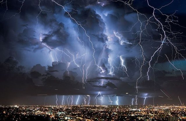
Catatumbo Lightning
Maracaibo Lowlands are also famous for catatumbo lightning. A atmospheric phenomenon in Venezuela where large lightning storms occur 140 to 160 nights a year, lasting around ten hours a day and lightning striking 280 times per hour.
Click on the image below to learn more.
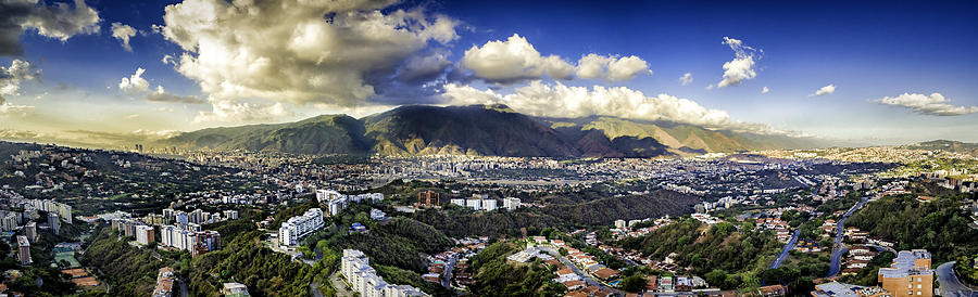
Northern Mountains
The northern mountains extend in a broad east-west arc from the Colombian border along the Caribbean Sea.
 Back to top
Wide Plains
The wide plains, also known as Los Llanos is a vast tropical grassland pla in situated to the east of the Andes in Colombia and Venezuela.

(click on image to enlarge)
Click on the image below to learn more about the Wide Plains, AKA Los Llanos.

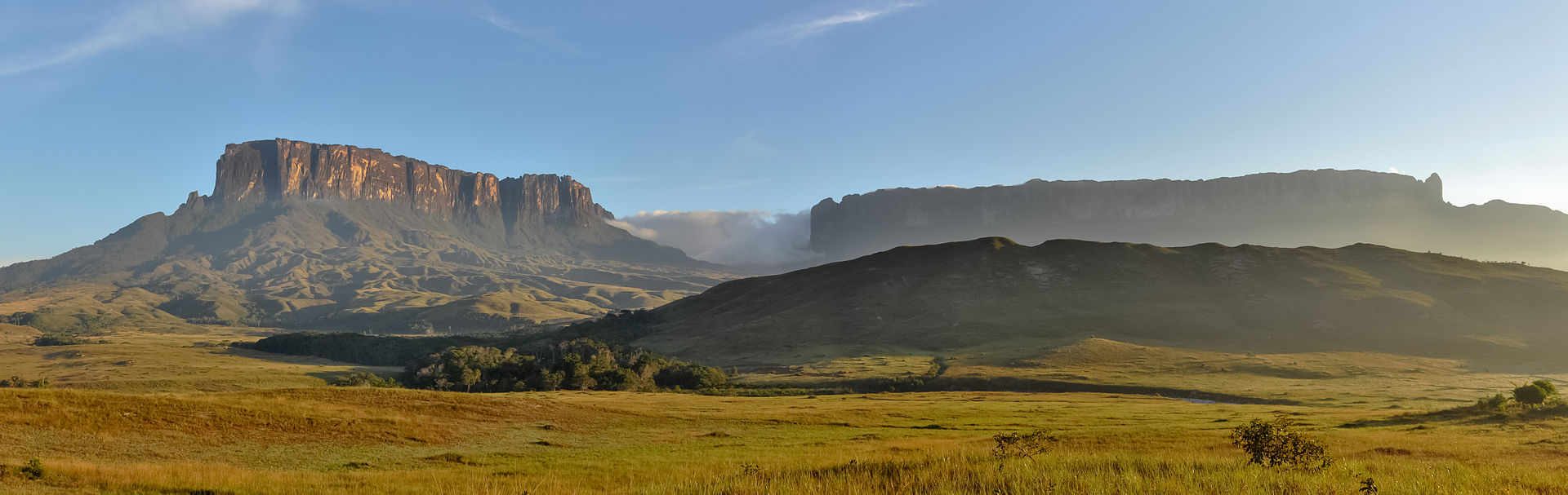
Guiana Highlands
The higher elevations on the Guiana Shield are called the Guiana Highlands.
Famous for their table like mountains called tepuis and the worlds tallest water fall Angel Falls.
To learn more about the Guiana Shield Click Here.
Tepuis mountains - Gran Sabana
Click on the image below to learn more about the Gran Sabana.
Angel Falls
To learn more about the Angel Falls Click Here.
Watch a group climbing Angel Falls.